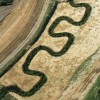
Mapping Saltmarsh Carbon Stocks

The CBESS (A hierarchical approach to the examination of the relationship between biodiversity and ecosystem service flows across coastal margins) project has produced a free tool for predicting and mapping carbon stock in salt marshes. The tool is for governmental and non-governmental organisations that have interests in salt marshes and are seeking information about natural carbon stores. There is also a saltmarsh app for the public that includes guides to saltmarsh species, background science and guidance on how to survey for carbon stock. Users can upload their survey results on the accompanying website.
Find out more by following this link to the Saltmarsh Carbon Tool and much more information about the importance and relevance of carbon in saltmarshes from the Saltmarsh App
Environment

The Manhood Peninsula Partnership was formed in recognition of the challenges the peninsula faces as a result of climate change and the increasing demands on its environment. By recognising the different issues the area faces, its assets and possibilities, and by valuing its distinct and almost unique character on the south coast, the MPP hopes to create opportunities and... Read More»
Chichester Harbour
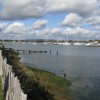
At 74km2, Chichester Harbour is the largest natural estuary in South East England. It is a living, working landscape, where over 10,000 people live. The Harbour straddles the county boundary between West Sussex and Hampshire, and every year, around 1.5 million people visit, whether to sail the waters or walk the network of footpaths. There are 14 sailing clubs in... Read More»
Medmerry
The RSPB's newest nature reserve at Medmerry offers long walks and cycle rides through an amazing new landscape only a stone's throw from Pagham Harbour, with new mudflats, tidal lagoons, saltmarsh, wildlife-friendly farmland, dragonfly-rich ditches and great views and sunsets. Situated on the Manhood Peninsula coast, south of Chichester, this is a ground breaking project and the first of its kind... Read More»